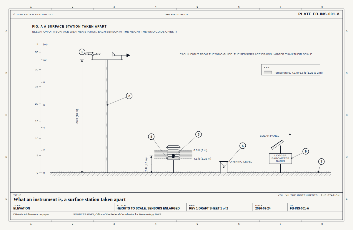
Drawn as the kind of place it stands at. 56 instruments in Vermont stand at one.
What the snow tracker reads here
Every instrument in this state
-in
Snow on the ground
Station charts
Rt-9 Searsburg Report
Rank
-
Days reported, 30 days
0 of 30
Time to reach Storm Station
19 min
Against its reference, 30 days
-2.9 °Fcooler than the airport station KDDH, 14 miles away, on average over 6 readings; typical difference 2.9 °F
Against its reference: each temperature this station reports is compared with the nearest airport or climate reference station that reported within half an hour, up to 15 miles away. The figure is its reading less the reference's, on average, as both were reported; the typical difference is the root mean square. The difference in height is shown where both heights are known.
The ranking these charts were drawn from, as tables
Share of scheduled reports received
Stations
100%
136
90 to 99%
54
80 to 89%
10
70 to 79%
7
60 to 69%
45
50 to 59%
1
40 to 49%
18
30 to 39%
10
20 to 29%
1
10 to 19%
1
0 to 9%
1
Station report
Rt-9 Searsburg, in 3 sheets
Drawn from the register, in the manner of the Field Book, and opened beside the plates that explain each part of it.
At 2,223 ft above sea level, 8 per cent of the atmosphere's air lies below the station. The standard atmosphere puts the pressure there at 27.59 inHg and the temperature at 51.1 F.
On Oct 4 the noon sun stands 43 degrees above the horizon at 42.89 N, and the day is 11 h 26 min long. Level ground there takes 68 per cent of the noon sunlight a surface facing the sun would.
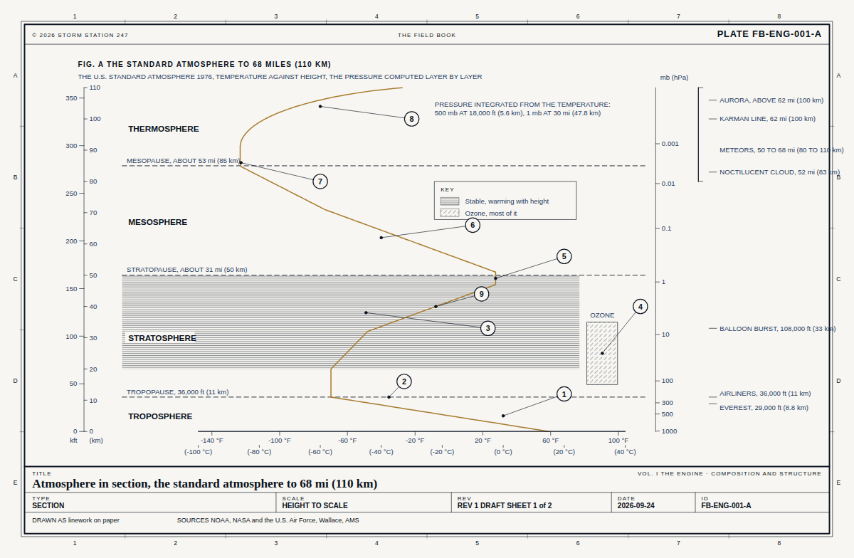 FB-ENG-001, Fig. AAtmosphere in section
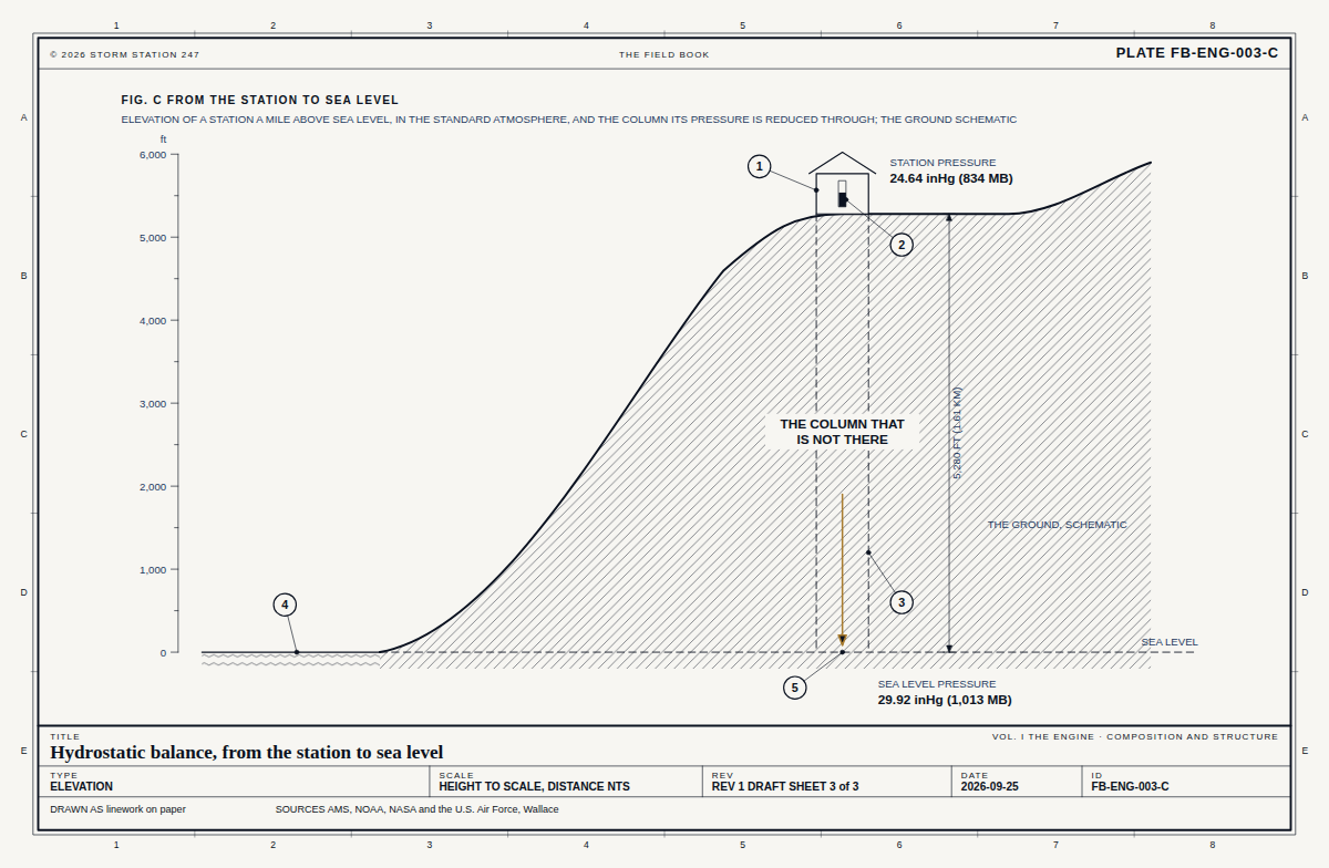 FB-ENG-003, Fig. CHydrostatic balance