What it is
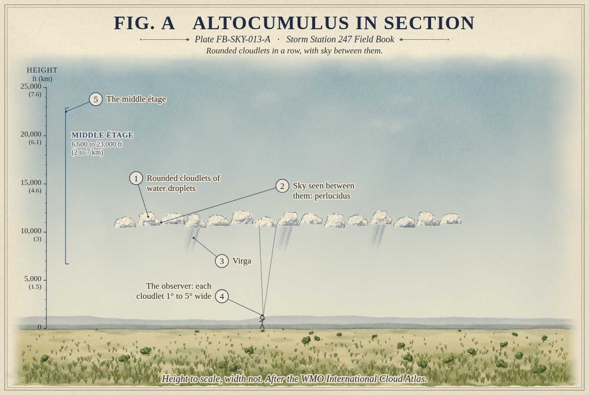
Altocumulus is a middle cloud of rounded masses, rolls or cloudlets, white or grey, in patches or sheets, usually with shading on one side. It stands in the middle étage, from 6,600 to 23,000 ft (2 to 7 km) in the middle latitudes, Cloud classification FB-SKY-001. Seen more than 30 degrees above the horizon, most of its elements are one to five degrees wide. It is made mostly of water droplets, often far below freezing.
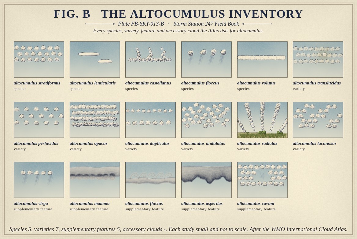
It is the most varied of the genera. The Atlas lists five species: stratiformis, a wide sheet; lenticularis, smooth lens shapes over and downwind of hills; castellanus, turrets rising from a common base; floccus, tufts with ragged bases; and volutus, a long tube that seems to roll. Seven varieties and five features can apply, from translucidus, thin enough to show the sun, to asperitas, a rough, chaotic underside. Fig. B draws every one.
What it is not
It is not cirrocumulus, Cirrocumulus FB-SKY-011, whose grains are under one degree wide and never shaded. It is not stratocumulus, Stratocumulus FB-SKY-016, whose elements are over five degrees wide and stand in the low étage. The width of the elements seen from the ground is the Atlas's own test, and it is drawn in Fig. A.
It is not altostratus, Altostratus FB-SKY-014, which is an even sheet without cloudlets.
Lookalikes
- Cirrocumulus
- Elements less than 1° wide, never shaded, and higher.
- Stratocumulus
- Elements more than 5° wide, and lower.
- Altostratus
- An even sheet with no cloudlets.
The machine
Altocumulus forms where a layer of moist air at middle levels is lifted or cooled to saturation and then stirred from within, so that it breaks into cells. Cooling at the top of the layer by radiation to space, or a change of wind speed with height across it, can do the stirring; the cells line up in rows where the wind sets them.
Its droplets are often supercooled. Some freeze, and the ice grows and falls as streaks, virga, that evaporate before they reach the ground: Fig. A draws three.
Two of its species say more than their shapes. Lenticularis is the lens cloud of mountain waves. Air flowing over a ridge rises and sinks in a train of waves downwind; the cloud forms at each crest and evaporates at each trough, so it stands still while the wind blows through it, Orographic clouds FB-SKY-035. Castellanus, turrets rising from a middle level base, shows air unstable at middle levels. On a summer morning it is a sign that thunderstorms may follow later in the day.
The drawings
Each figure drawn as an engineering sheet, its parts numbered, to print at 11 by 17.
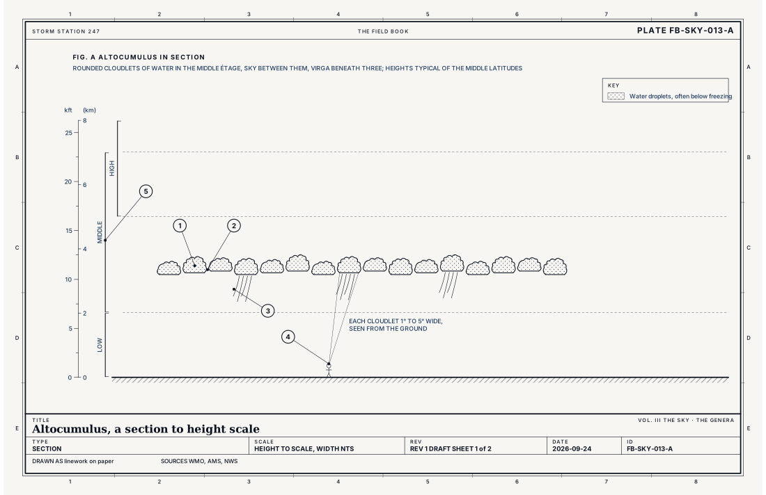
- Rounded cloudlets of water droplets
- Sky seen between them: perlucidus
- Virga
- The observer: each cloudlet 1° to 5° wide
- The middle étage
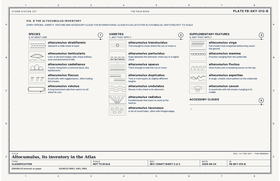
- Species, at most one
- Varieties, any that apply
- Supplementary features, any that apply
- Accessory clouds, any that apply
Ingredients
- Moist air at middle levels, lifted or cooled to saturation
- A layer stirred from within, by cooling at its top or by the wind changing with height, which breaks it into cells
- Waves in the air flowing over mountains, for the lens shaped kind
Scales
- time
- minutes for one cloudlet; hours for a sheet
- horizontal
- a patch of a few miles to a sheet of hundreds of miles
- vertical
- a few hundred feet to about 3,300 ft (1 km) deep, in the middle étage
- orlanski
- meso
Signatures
- surface
- a layer between 6,600 and 12,000 ft in the sky report when it is low enough for the ceilometer
- satellite
- a patchy layer, often in rows or waves
- radar
- no echo, except for heavy virga
The numbers
| Quantity | Value, and the kind of number it is |
|---|---|
| Abbreviation | AcStandard, International Cloud Atlas |
| Étage | Middle: 6,600 to 23,000 ft (2 to 7 km) in the middle latitudesStandard, International Cloud Atlas |
| Made of | Water droplets, often supercooled; ice crystals when very coldStandard, International Cloud Atlas |
| Element size | Most elements 1° to 5° wide, seen more than 30° above the horizonStandard, International Cloud Atlas |
| Species | 5: stratiformis, lenticularis, castellanus, floccus, volutusStandard, International Cloud Atlas |
| Varieties | 7: translucidus, perlucidus, opacus, duplicatus, undulatus, radiatus, lacunosusStandard, International Cloud Atlas |
| Supplementary features | 5: virga, mamma, fluctus, asperitas, cavumStandard, International Cloud Atlas |
| Accessory clouds | -Standard, International Cloud Atlas |
| Airport ceilometer | Cloud bases to 12,000 ft (3.7 km) overheadStandard, Automated Surface Observing System (ASOS) User's Guide |
How the station sees it
An airport station measures cloud overhead with a laser ceilometer to 12,000 ft (3.7 km), and reports each layer's cover and base height in eighths of the sky. Altocumulus with its base below that height appears in the report as a layer; the station does not name the genus. Above 12,000 ft it is added from sight at staffed stations. Satellites show it as a patchy layer, often in rows or waves.
- Airport weather stations: the cover and height of each layer overhead, to 12,000 ft
How it is warned
Altocumulus is not warned. Its lens shapes mark strong mountain waves, which forecasters watch for aircraft turbulence, and its castellanus is one of the older signs of an unstable afternoon. Thin altocumulus in front of the sun or moon can make a corona or iridescence, Corona, iridescence and glory FB-SKY-052. Neither is a warning; both are the sky showing how the air at its middle levels is moving.
See also
- Cloud classification FB-SKY-001
- Cirrocumulus FB-SKY-011
- Altostratus FB-SKY-014
- Stratocumulus FB-SKY-016
- Orographic clouds FB-SKY-035
- Corona, iridescence and glory FB-SKY-052
Sources
- World Meteorological Organization. International Cloud Atlas.
- American Meteorological Society. Glossary of Meteorology.
- National Weather Service. Automated Surface Observing System (ASOS) User's Guide.
Definition after the International Cloud Atlas. Plate FB-SKY-013, revision 1, 2026-09-24. The number is permanent; cite it.