What it is
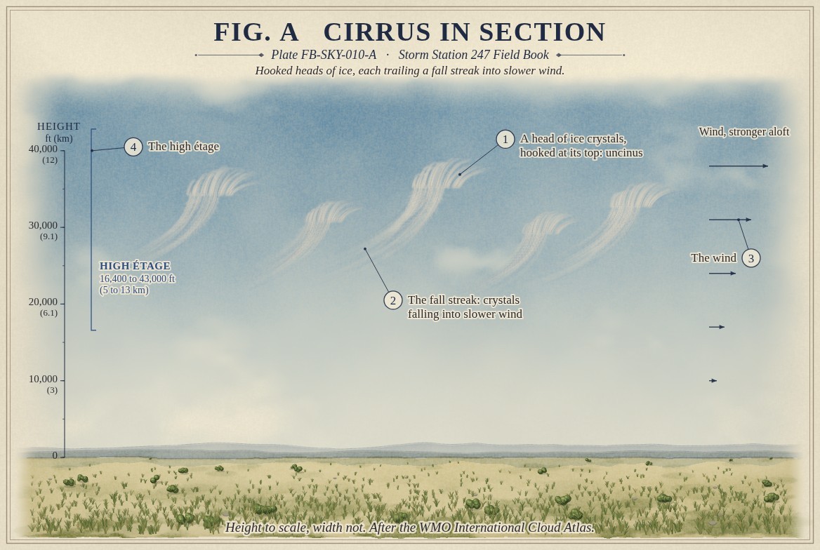
Cirrus is the highest of the common clouds: white filaments, hooks and narrow bands of ice, fibrous in look and often with a silky sheen. It forms in the high étage, from 16,400 to 43,000 ft (5 to 13 km) in the middle latitudes, where the air is far below freezing and nearly all cloud is ice. The name is Latin for a curl of hair, one of the four roots of the classification, Cloud classification FB-SKY-001.
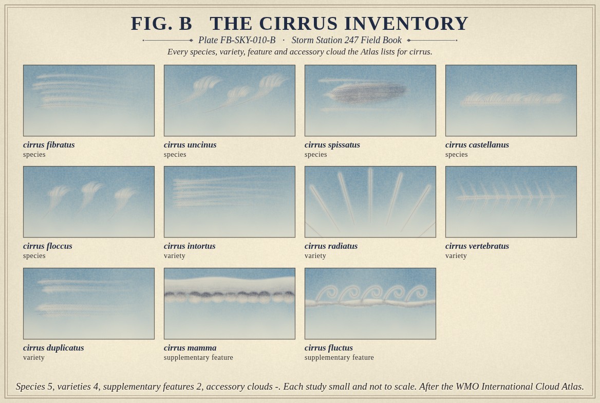
The Atlas lists five species of cirrus, by shape: fibratus, straight or gently curved filaments; uncinus, hooked like a comma, the cloud often called mares' tails; spissatus, patches dense enough to look grey toward the sun; castellanus, small turrets on a common base; and floccus, tufts with ragged bases. Four varieties describe how the filaments lie, and two features, mamma and fluctus, can appear with it. Fig. B draws each one.
What it is not
It is not cirrostratus, Cirrostratus FB-SKY-012, which is a veil over much of the sky and makes the halo. It is not cirrocumulus, Cirrocumulus FB-SKY-011, which is made of small grains, not filaments. A straight line of cloud along an aircraft's path is a contrail; when one lasts and spreads, the Atlas names it cirrus homogenitus.
Cirrus alone does not bring rain. Its crystals fall, but they evaporate in the drier air below long before they reach the ground.
Lookalikes
- Cirrostratus
- A veil over much of the sky, often with a halo. Cirrus stands in separate filaments or patches.
- Cirrocumulus
- Small grains or ripples, not filaments.
- Contrails
- A straight line along an aircraft's path. One that lasts and spreads becomes cirrus homogenitus.
- Altostratus
- A grey sheet, lower, thick enough to dim the sun.
The machine
Cirrus forms where moist air is lifted high enough for its vapour to freeze onto tiny particles as ice. The lifting may be a broad slow ascent ahead of a warm front, the outflow from the top of a thunderstorm, or a wave in the air over mountains. Once formed, the crystals grow and fall.
Fig. A draws what the falling does. The wind at cirrus height is usually stronger than the wind below it. The head, where the crystals form, moves with the fast air; the crystals falling from it enter slower air and are left behind. The trail they leave bends down and back into a hook or a streak: the fall streak. The shape of cirrus is a record of how the wind changes with height, drawn in ice.
Cirrus ahead of a warm front often thickens over some hours into cirrostratus and then altostratus, Altostratus FB-SKY-014, as the front comes nearer and the cloud lowers. A sky of cirrus spreading and thickening from one direction is the first sign of that sequence. Scattered cirrus that does not thicken usually means nothing more than moist air aloft.
The thick cirrus that spreads from the anvil of a thunderstorm is named for where it came from: cirrus spissatus cumulonimbogenitus, cirrus born of a cumulonimbus. It can drift hundreds of miles from the storm that made it.
The drawings
Each figure drawn as an engineering sheet, its parts numbered, to print at 11 by 17.
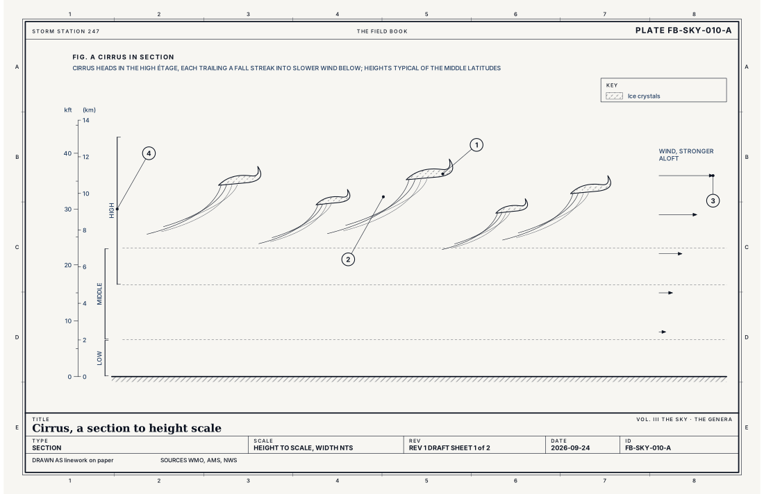
- A head of ice crystals, hooked at its top: uncinus
- The fall streak: crystals falling into slower wind
- The wind, stronger aloft
- The high étage
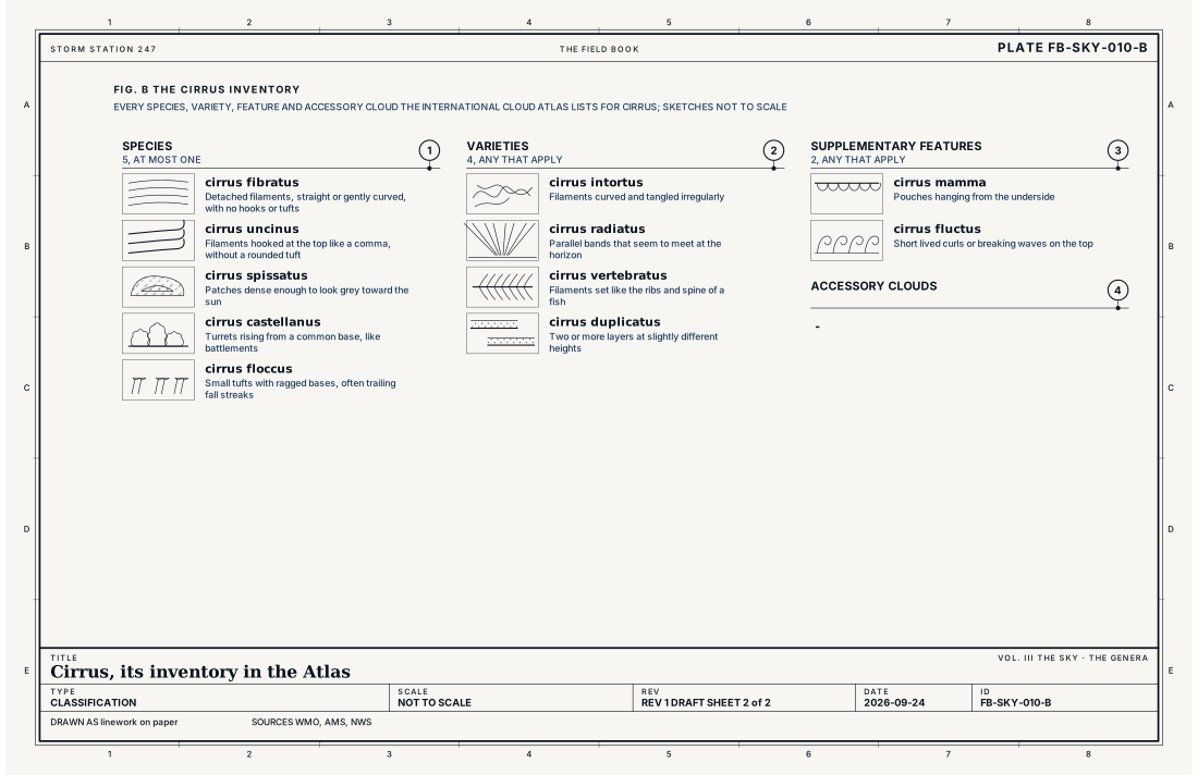
- Species, at most one
- Varieties, any that apply
- Supplementary features, any that apply
- Accessory clouds, any that apply
Ingredients
- Moist air lifted high enough to cool far below freezing, where ice crystals form and grow
- Wind that changes speed or direction with height, which draws the falling crystals into streaks
- Drier air below, in which the falling crystals evaporate before they reach the ground
Scales
- time
- minutes to hours for one streak; a spreading sheet can last a day
- horizontal
- a streak from under a mile to tens of miles long
- vertical
- a few hundred feet to about a mile (1.6 km) deep, in the high étage
- orlanski
- meso and synoptic
Signatures
- surface
- added to the sky report from sight at staffed stations
- satellite
- cold in the infrared, often faint or unseen in the visible
- radar
- no echo
The numbers
| Quantity | Value, and the kind of number it is |
|---|---|
| Abbreviation | CiStandard, International Cloud Atlas |
| Étage | High: 16,400 to 43,000 ft (5 to 13 km) in the middle latitudesStandard, International Cloud Atlas |
| Made of | Ice crystalsStandard, International Cloud Atlas |
| Species | 5: fibratus, uncinus, spissatus, castellanus, floccusStandard, International Cloud Atlas |
| Varieties | 4: intortus, radiatus, vertebratus, duplicatusStandard, International Cloud Atlas |
| Supplementary features | 2: mamma, fluctusStandard, International Cloud Atlas |
| Accessory clouds | -Standard, International Cloud Atlas |
| Contrails | A contrail that lasts and spreads is named cirrus homogenitus, and cirrus homomutatus once it no longer looks like a trailStandard, International Cloud Atlas |
| Airport ceilometer | Cloud bases to 12,000 ft (3.7 km) overheadStandard, Automated Surface Observing System (ASOS) User's Guide |
How the station sees it
An airport station measures cloud overhead with a laser ceilometer, up to 12,000 ft (3.7 km). Cirrus stands higher, so the station's own sky report does not carry it. Observers at staffed stations add high cloud from sight. Satellites see it well: thin cirrus is cold in the infrared images and often faint in the visible ones, which is how a forecaster tells a high veil from low cloud.
- Airport weather stations: cloud overhead to 12,000 ft; this cloud stands higher
How it is warned
Cirrus is not warned. The one cirrus tied to storms is the anvil blown off the top of a cumulonimbus, Cumulonimbus FB-SKY-019: a sheet of thick cirrus with a hard edge on the horizon, on a summer afternoon, can be the top of a thunderstorm still below the horizon. The warning, when it comes, is for the storm beneath it, Thunderstorm FB-EVT-001.
See also
- Cloud classification FB-SKY-001
- Cirrocumulus FB-SKY-011
- Cirrostratus FB-SKY-012
- Altostratus FB-SKY-014
- Cumulonimbus FB-SKY-019
- Special clouds FB-SKY-034
- Halo family FB-SKY-051
Sources
- World Meteorological Organization. International Cloud Atlas.
- American Meteorological Society. Glossary of Meteorology.
- National Weather Service. Automated Surface Observing System (ASOS) User's Guide.
- Wallace, J. M. and P. V. Hobbs. Atmospheric Science, An Introductory Survey, 2nd ed. (2006).
Definition after the International Cloud Atlas. Plate FB-SKY-010, revision 1, 2026-09-24. The number is permanent; cite it.