What it is
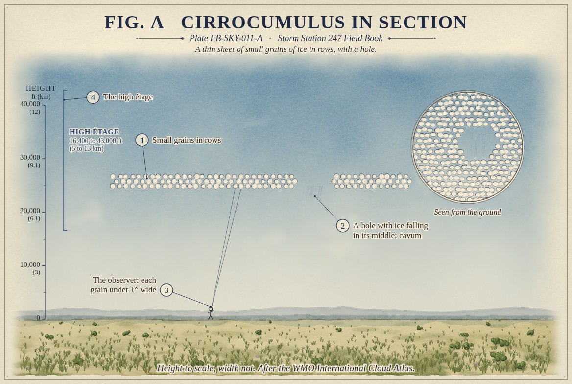
Cirrocumulus is a thin high sheet or patch of cloud made of very small grains, ripples or rounded elements, white and without shading, in rows or scattered. It stands in the high étage, from 16,400 to 43,000 ft (5 to 13 km) in the middle latitudes, with cirrus and cirrostratus, Cloud classification FB-SKY-001. Its grains are the smallest elements of any cloud: seen more than 30 degrees above the horizon, most are less than one degree wide.
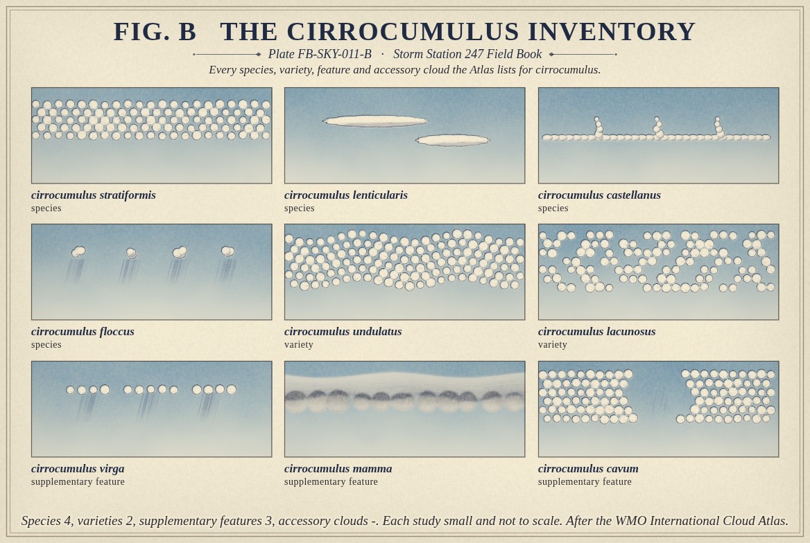
The Atlas lists four species: stratiformis, a wide sheet; lenticularis, lens shaped patches over and downwind of hills; castellanus, with small turrets; and floccus, tufts with ragged bases. Two varieties, undulatus and lacunosus, describe waves in the sheet and a net of holes. Three features, virga, mamma and cavum, can come with it. Fig. B draws each one. A sky of cirrocumulus in rows is one of the skies called a mackerel sky.
What it is not
It is not altocumulus, Altocumulus FB-SKY-013. The difference is the size of the elements and their shading: altocumulus elements are one to five degrees wide, often grey on one side, and stand lower, in the middle étage. When the two are hard to tell apart the Atlas settles it by that width alone.
It is not cirrus, Cirrus FB-SKY-010, which is filaments, and not cirrostratus, Cirrostratus FB-SKY-012, which is an even veil with no grains at all.
Lookalikes
- Altocumulus
- Elements 1° to 5° wide, often shaded on one side, and lower, in the middle étage.
- Cirrus
- Filaments and hooks, not grains.
- Cirrostratus
- An even veil with no grains; it makes the halo.
The machine
Cirrocumulus forms where a thin layer high in the troposphere is lifted to saturation and stirred from within, so that it breaks into small cells or rows. Waves in the air flowing over mountains, or a change of wind with height across the layer, can set the rows. The cloud holds supercooled droplets, liquid water far below freezing, as well as ice.
Those droplets are why cirrocumulus seldom lasts. As they freeze, the grains turn fibrous and the patch becomes cirrus or cirrostratus, often within minutes. Where one part of a sheet freezes first, its ice grows at the droplets' expense and falls, and a round hole opens in the cloud with streaks of ice hanging in its middle: cavum, the fallstreak hole, drawn in Fig. A. An aircraft climbing through such a sheet can start the same freezing along its path.
Thin cirrocumulus in front of the sun or moon can make a corona or iridescence, rings and fringes of colour from light bent round its small, even droplets, Corona, iridescence and glory FB-SKY-052.
The drawings
Each figure drawn as an engineering sheet, its parts numbered, to print at 11 by 17.
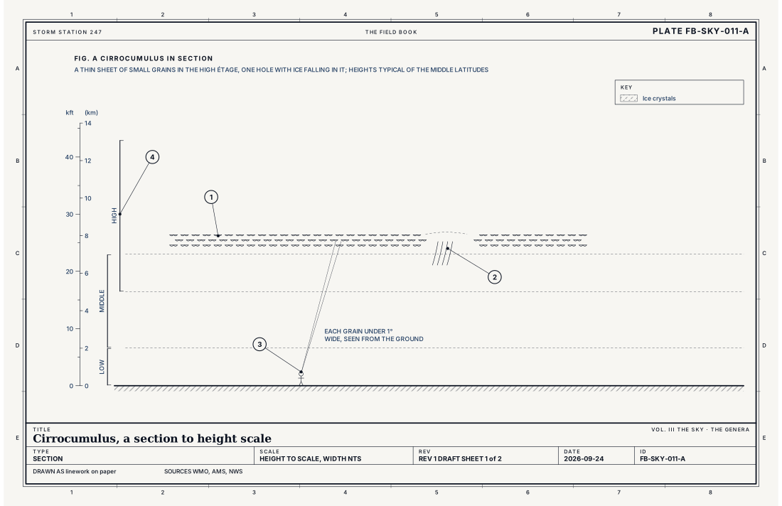
- Small grains in rows
- A hole with ice falling in its middle: cavum
- The observer: each grain under 1° wide
- The high étage
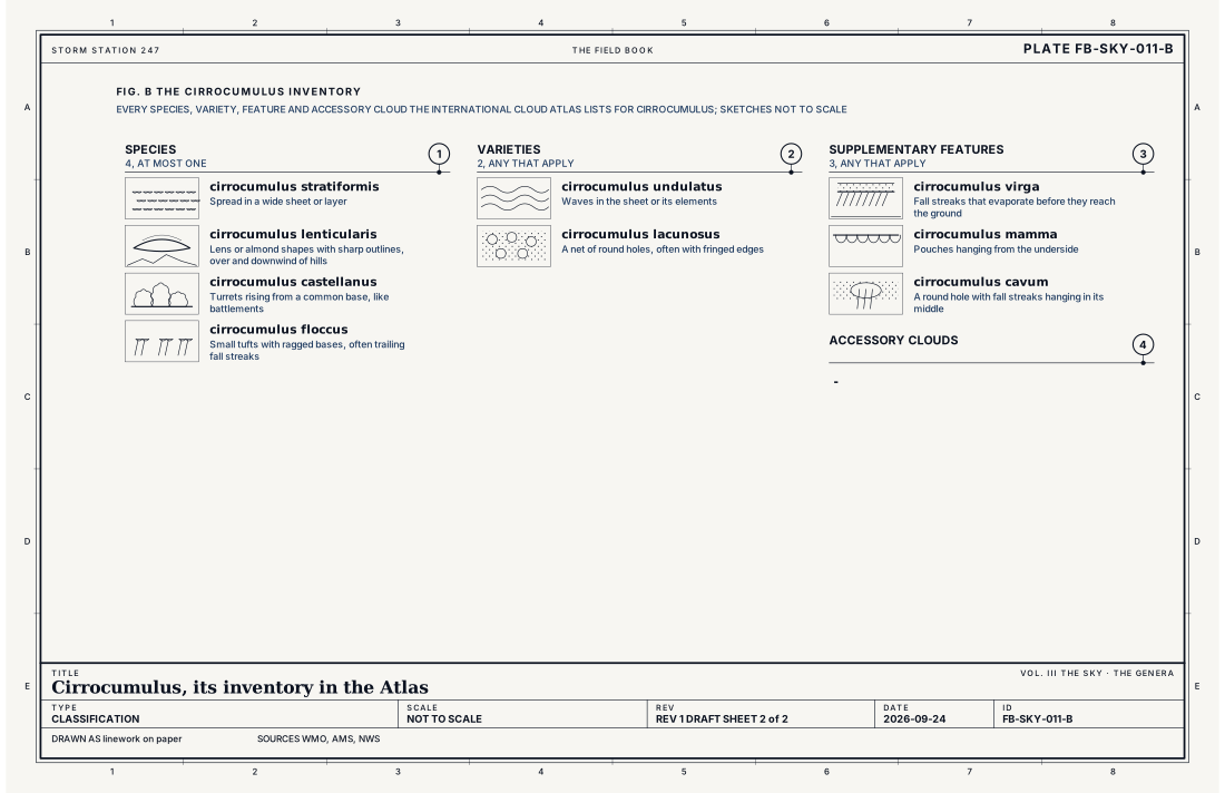
- Species, at most one
- Varieties, any that apply
- Supplementary features, any that apply
- Accessory clouds, any that apply
Ingredients
- Moist air lifted high in the troposphere, often in a wave
- A thin layer stirred from within, which breaks the sheet into small cells or ripples
- Droplets cooled below freezing that have not yet frozen
Scales
- time
- minutes to an hour; its droplets freeze quickly
- horizontal
- a patch of a few miles to a sheet of tens of miles
- vertical
- a few hundred feet deep, in the high étage
- orlanski
- meso
Signatures
- surface
- added to the sky report from sight at staffed stations
- satellite
- thin and high; hard to tell from other high cloud in the images
- radar
- no echo
The numbers
| Quantity | Value, and the kind of number it is |
|---|---|
| Abbreviation | CcStandard, International Cloud Atlas |
| Étage | High: 16,400 to 43,000 ft (5 to 13 km) in the middle latitudesStandard, International Cloud Atlas |
| Made of | Ice crystals, often with supercooled water droplets that soon freezeStandard, International Cloud Atlas |
| Element size | Most elements less than 1° wide, seen more than 30° above the horizonStandard, International Cloud Atlas |
| Species | 4: stratiformis, lenticularis, castellanus, floccusStandard, International Cloud Atlas |
| Varieties | 2: undulatus, lacunosusStandard, International Cloud Atlas |
| Supplementary features | 3: virga, mamma, cavumStandard, International Cloud Atlas |
| Accessory clouds | -Standard, International Cloud Atlas |
| Airport ceilometer | Cloud bases to 12,000 ft (3.7 km) overheadStandard, Automated Surface Observing System (ASOS) User's Guide |
How the station sees it
An airport station measures cloud overhead with a laser ceilometer to 12,000 ft (3.7 km). Cirrocumulus stands well above that, so the station's sky report does not carry it; staffed stations add it from sight. From a satellite it is hard to separate from other thin high cloud, and it is usually known by eye from the ground.
- Airport weather stations: cloud overhead to 12,000 ft; this cloud stands higher
How it is warned
Cirrocumulus is not warned and brings no weather to the ground. Its supercooled droplets matter to aircraft: cloud of liquid water below freezing can ice an airframe that flies through it, and icing is forecast for pilots rather than warned to the public. The cloud's shape is its message to a reader on the ground: moist, stirred air high up, often ahead of a change.
See also
- Cloud classification FB-SKY-001
- Cirrus FB-SKY-010
- Cirrostratus FB-SKY-012
- Altocumulus FB-SKY-013
- Supplementary features atlas FB-SKY-032
- Corona, iridescence and glory FB-SKY-052
Sources
- World Meteorological Organization. International Cloud Atlas.
- American Meteorological Society. Glossary of Meteorology.
- National Weather Service. Automated Surface Observing System (ASOS) User's Guide.
Definition after the International Cloud Atlas. Plate FB-SKY-011, revision 1, 2026-09-24. The number is permanent; cite it.