What it is
Nimbostratus is a thick, dark grey cloud layer, often dim and wet looking, from which rain or snow falls steadily. It is thick enough to hide the sun everywhere. Its base is often hard to see, lost in the falling rain and in ragged low cloud beneath it. The Atlas counts it as a middle cloud, but it usually reaches down into the low étage and up into the high, Cloud classification FB-SKY-001.
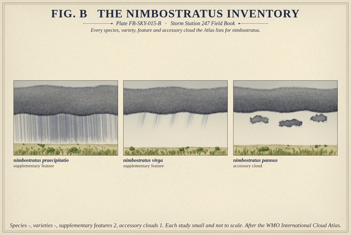
It is the plainest of the genera in the Atlas: no species and no varieties. Two supplementary features, praecipitatio, rain or snow reaching the ground, and virga, and one accessory cloud, pannus, the ragged shreds beneath it, are all it carries. Fig. B draws each.
What it is not
It is not altostratus, Altostratus FB-SKY-014, which is thinner and higher and shows the sun in places. It is not stratus, Stratus FB-SKY-017, which is low and flat and gives drizzle, not rain. It is not cumulonimbus, Cumulonimbus FB-SKY-019, which is heaped and gives showers that start and stop, with lightning and thunder. Rain from nimbostratus is steady: it can fall for hours at nearly the same rate.
Lookalikes
- Altostratus
- Thinner and higher; the sun shows through it in places.
- Stratus
- Low and flat, with drizzle rather than rain or snow.
- Cumulonimbus
- Heaped, with showers, lightning and thunder.
The machine
Nimbostratus forms where a deep layer of moist air is lifted broadly and slowly for hours, over a warm front or around a low, until the cloud reaches from near the ground to 10,000 ft (3 km) or far higher. The lift is gentle and wide, so the cloud is a layer; it is sustained, so the layer keeps making rain and snow.
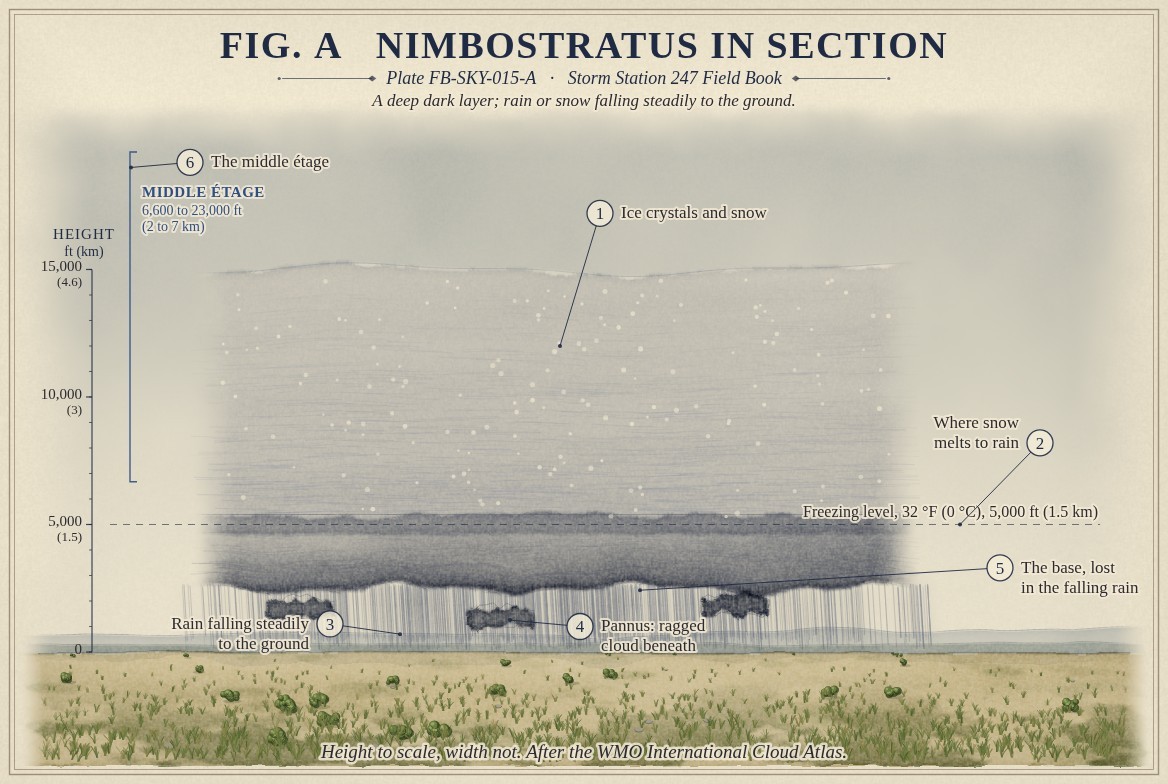
Fig. A draws what happens inside it. In its upper part, where the air is below freezing, ice crystals grow at the expense of supercooled droplets and clump into snowflakes. They fall through the freezing level, 32 °F (0 °C), and melt into raindrops below it. When the freezing level is at or near the ground, the snow reaches the ground as snow; when a warm layer sits over a cold one near the ground, it can arrive as sleet or freezing rain. On radar the melting layer often shows as a bright band, because a wet snowflake reflects the beam strongly.
The falling rain moistens the air under the base, and shreds of cloud form in it: pannus, or scud, drawn under the base in Fig. A. They drift faster than the layer above and are often mistaken for the cloud's own base.
The drawings
Each figure drawn as an engineering sheet, its parts numbered, to print at 11 by 17.
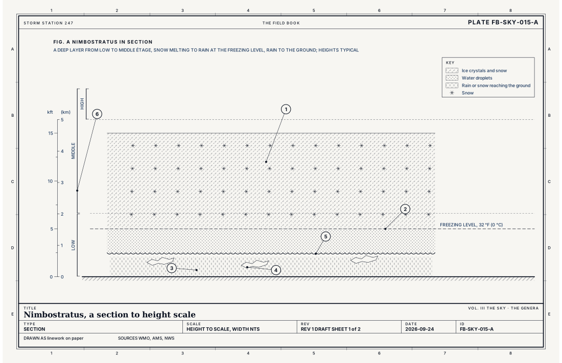
- Ice crystals and snow
- The freezing level, 32 °F (0 °C), where snow melts to rain
- Rain or snow falling steadily to the ground
- Pannus: ragged cloud beneath
- The base, lost in the falling rain
- The middle étage
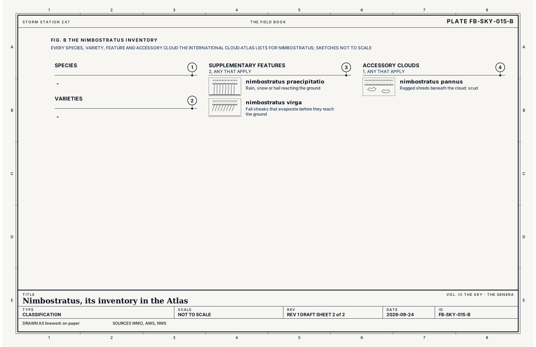
- Species, at most one
- Varieties, any that apply
- Supplementary features, any that apply
- Accessory clouds, any that apply
Ingredients
- A deep layer of moist air lifted broadly and slowly for hours, as over a warm front or around a low
- Ice crystals growing in the upper part, which fall as snow
- A melting level, below which the snow turns to rain when the air is warm enough
Scales
- time
- hours to a day or more of steady rain or snow
- horizontal
- hundreds of miles, the heart of a storm's cloud shield
- vertical
- from near the ground to 10,000 ft (3 km) or far higher
- orlanski
- synoptic
Signatures
- surface
- a low ceiling, steady rain or snow, and visibility cut by it
- satellite
- a wide, deep, cold cloud shield
- radar
- a broad even echo, often with a bright band where snow melts to rain
The numbers
| Quantity | Value, and the kind of number it is |
|---|---|
| Abbreviation | NsStandard, International Cloud Atlas |
| Étage | Counted as middle; usually extends into the low and the highStandard, International Cloud Atlas |
| Made of | Water droplets and raindrops below, ice crystals and snowflakes aboveStandard, International Cloud Atlas |
| What falls | Continuous rain, snow or ice pellets, not showersStandard, International Cloud Atlas |
| The sun | Hidden everywhereStandard, International Cloud Atlas |
| Species | -Standard, International Cloud Atlas |
| Varieties | -Standard, International Cloud Atlas |
| Supplementary features | 2: praecipitatio, virgaStandard, International Cloud Atlas |
| Accessory clouds | 1: pannusStandard, International Cloud Atlas |
| Airport ceilometer | Cloud bases to 12,000 ft (3.7 km) overheadStandard, Automated Surface Observing System (ASOS) User's Guide |
How the station sees it
An airport station reports nimbostratus as a low overcast, its ceiling often under a few thousand feet and falling as the rain goes on; the station does not name the genus. It reports the steady rain or snow, its rate and the visibility cut by it. On radar the cloud's rain shows as a wide, even echo, often hundreds of miles across, with the bright band where snow melts.
- Airport weather stations: the cover and height of each layer overhead, to 12,000 ft
- The radar on the live map: the rain and hail falling from it, every few minutes
How it is warned
The cloud is not warned; what falls from it is. Steady rain for many hours over the same ground can flood rivers and streets, Flash flood FB-EVT-100; steady snow can build to a winter storm; and a warm layer aloft can turn it to freezing rain. Each has its own watch and warning from the Weather Service, and each comes from this cloud.
See also
- Cloud classification FB-SKY-001
- Altostratus FB-SKY-014
- Stratus FB-SKY-017
- Rain FB-WAT-010
- Snow FB-WAT-012
- Flash flood FB-EVT-100
Sources
- World Meteorological Organization. International Cloud Atlas.
- American Meteorological Society. Glossary of Meteorology.
- National Weather Service. Automated Surface Observing System (ASOS) User's Guide.
Definition after the International Cloud Atlas. Plate FB-SKY-015, revision 1, 2026-09-24. The number is permanent; cite it.