Station report
Dutch Harbor, in 6 sheets Drawn from its report of Sep 30, 2026, 5:56 AM local time, in the manner of the Field Book, and opened beside the plates that explain each part of it.
1 The sky2 The air3 The wind4 The column5 The sun6 The instrumentScattered at 3,000 ft, broken at 3,900 ft, overcast at 6,000 ft; the ceiling is 3,900 ft; visibility 10 mi or more.
Section of the sky over Dutch Harbor, height above the station to scale: scattered cloud with its base at 3,000 feet, broken cloud with its base at 3,900 feet, overcast cloud with its base at 6,000 feet, the ceiling at 3,900 feet, and visibility of 10 mi or more. 1 1 2 2 3 3 4 4 5 5 6 6 7 7 8 8 A A B B C C D D E E © 2026 STORM STATION 247 THE FIELD BOOK STATION REPORT PADU FIG. A THE SKY OVER DUTCH HARBOR SECTION, HEIGHT ABOVE THE STATION TO SCALE, EACH LAYER AT THE HEIGHT OF ITS BASE AS REPORTED; COVER IN EIGHTHS OF THE SKY; TOPS NOT MEASURED FT ABOVE THE STATION 0 2,500 5,000 7,500 10,000 ETAGES LOW MIDDLE THE STATION THE CEILOMETER READS TO 12,000 FT, ABOVE THIS SHEET OVC 6,000 FT OVERCAST, 8 EIGHTHS OF THE SKY BKN 3,900 FT BROKEN, 5 TO 7 EIGHTHS OF THE SKY SCT 3,000 FT SCATTERED, 3 TO 4 EIGHTHS OF THE SKY CEILING 3,900 FT VISIBILITY, MILES: 10 MI OR MORE 0 5 10 TITLE Dutch Harbor, the sky STATION REPORT · ASOS PADU TYPE SECTION SCALE HEIGHT TO SCALE REV AS REPORTED SHEET 1 of 6 DATE 2026-09-30 ID SR-PADU-1 DRAWN AS linework on paper SOURCES FB-SKY-001, FB-SKY-017, FB-SKY-016, FB-SKY-018 From the Field Book FB-SKY-001, Fig. A Cloud classification The ten cloud genera by height: the etages these layers fall in.
FB-SKY-017, Fig. A Stratus A cloud with its base at 3,000 ft is in the low etage, where stratus forms.
FB-SKY-016, Fig. A Stratocumulus A cloud with its base at 3,000 ft is in the low etage, where stratocumulus forms.
FB-SKY-018, Fig. A Cumulus A cloud with its base at 3,000 ft is in the low etage, where cumulus forms.
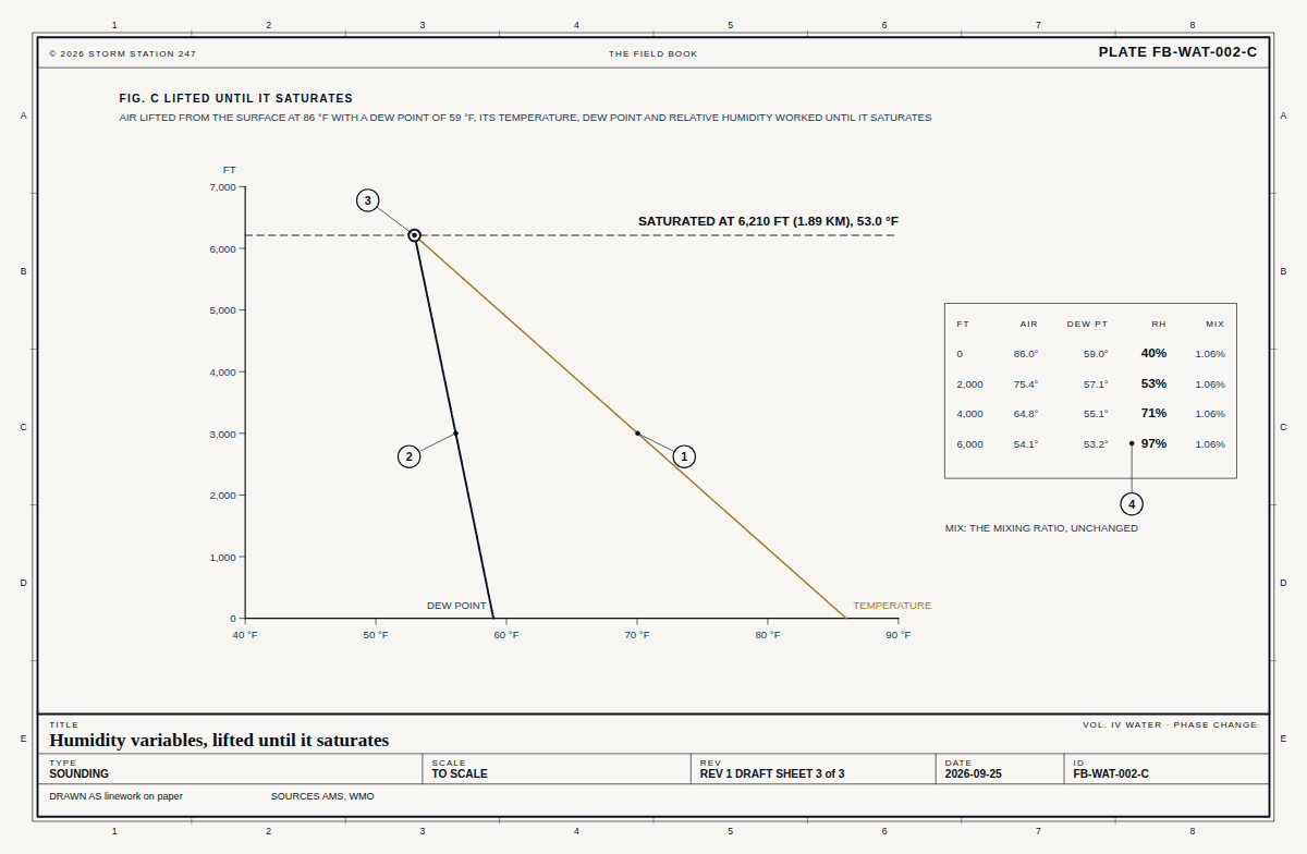
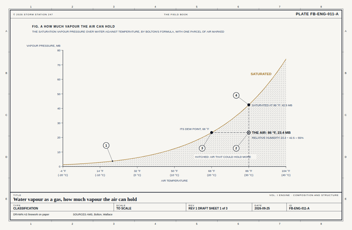
46.0 F with a dew point of 40.0 F, 79 per cent relative humidity. Air lifted from the station would cool to its dew point, where cloud forms, about 1,400 ft up; the lowest cloud reported is at 3,000 ft.
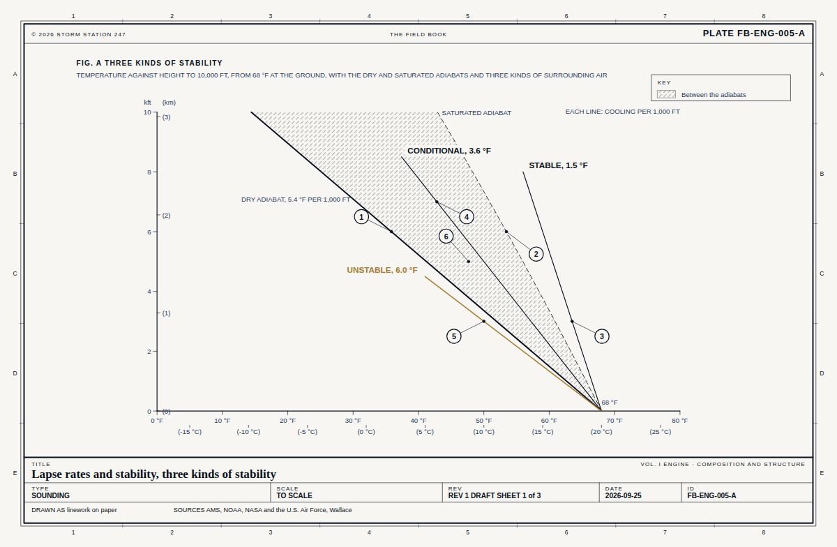
Chart of the air at Dutch Harbor: temperature 46.0 degrees Fahrenheit and dew point 40.0, 79 per cent relative humidity; air lifted from the station cools along the dry rate and meets its dew point about 1,400 feet above the station, against the lowest cloud reported at 3,000 feet; height to scale. 1 1 2 2 3 3 4 4 5 5 6 6 7 7 8 8 A A B B C C D D E E © 2026 STORM STATION 247 THE FIELD BOOK STATION REPORT PADU FIG. B THE AIR AT DUTCH HARBOR THE REPORTED TEMPERATURE AND DEW POINT, AND AIR LIFTED FROM THE STATION WITHOUT MIXING UNTIL IT SATURATES; HEIGHT ABOVE THE STATION TO SCALE FT ABOVE THE STATION 0 1,000 2,000 3,000 4,000 30 F 40 F 50 F 60 F SATURATES 1,400 FT ABOVE THE STATION, AT 38.7 F LOWEST CLOUD REPORTED, SCT 3,000 FT TEMPERATURE 46.0 F DEW POINT 40.0 F SPREAD 6.0 F RELATIVE HUMIDITY 79 PER CENT THE AIR COOLS ABOUT 5.4 F EACH 1,000 FT IT RISES, AND ITS DEW POINT ABOUT 1 F SOLID: THE LIFTED AIR'S TEMPERATURE; DASHED: ITS DEW POINT TITLE Dutch Harbor, the air STATION REPORT · ASOS PADU TYPE CHART SCALE HEIGHT TO SCALE REV AS REPORTED SHEET 2 of 6 DATE 2026-09-30 ID SR-PADU-2 DRAWN AS linework on paper SOURCES FB-WAT-002, FB-ENG-011, FB-ENG-005 From the south (190 degrees) at 8 mph: force 3, a gentle breeze on the Beaufort scale. The strongest gust today was 20 mph.
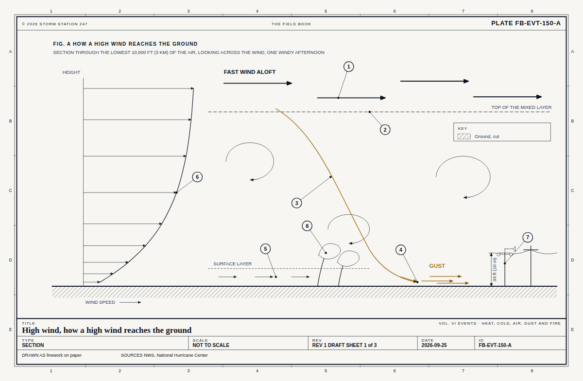
Plan of the wind at Dutch Harbor, north up: blowing from 190 degrees, the south, at 8 miles an hour; beside it the Beaufort scale from calm to hurricane force, force 3, gentle breeze, marked. 1 1 2 2 3 3 4 4 5 5 6 6 7 7 8 8 A A B B C C D D E E © 2026 STORM STATION 247 THE FIELD BOOK STATION REPORT PADU FIG. C THE WIND AT DUTCH HARBOR PLAN, NORTH UP: THE WIND AS REPORTED, AND WHERE IT SITS ON THE BEAUFORT SCALE N E S W THE STATION FROM 190° BEAUFORT FORCE LEAST WIND, MPH 0 CALM 0 1 LIGHT AIR 1 2 LIGHT BREEZE 4 3 GENTLE BREEZE 8 NOW, 8 MPH 4 MODERATE BREEZE 13 5 FRESH BREEZE 19 6 STRONG BREEZE 25 7 NEAR GALE 32 8 GALE 39 9 STRONG GALE 47 10 STORM 55 11 VIOLENT STORM 64 12 HURRICANE FORCE 73 TITLE Dutch Harbor, the wind STATION REPORT · ASOS PADU TYPE PLAN north up SCALE NOT TO SCALE REV AS REPORTED SHEET 3 of 6 DATE 2026-09-30 ID SR-PADU-3 DRAWN AS linework on paper SOURCES FB-EVT-150, FB-ENG-008, FB-INS-002 At 13 ft above sea level, 0 per cent of the atmosphere's air lies below the station. The standard atmosphere puts the pressure there at 29.91 inHg and the temperature at 59.0 F; the station's altimeter setting of 29.96 inHg means its barometer reads 29.95 inHg; it reports 46.0 F, 13.0 F colder than standard.
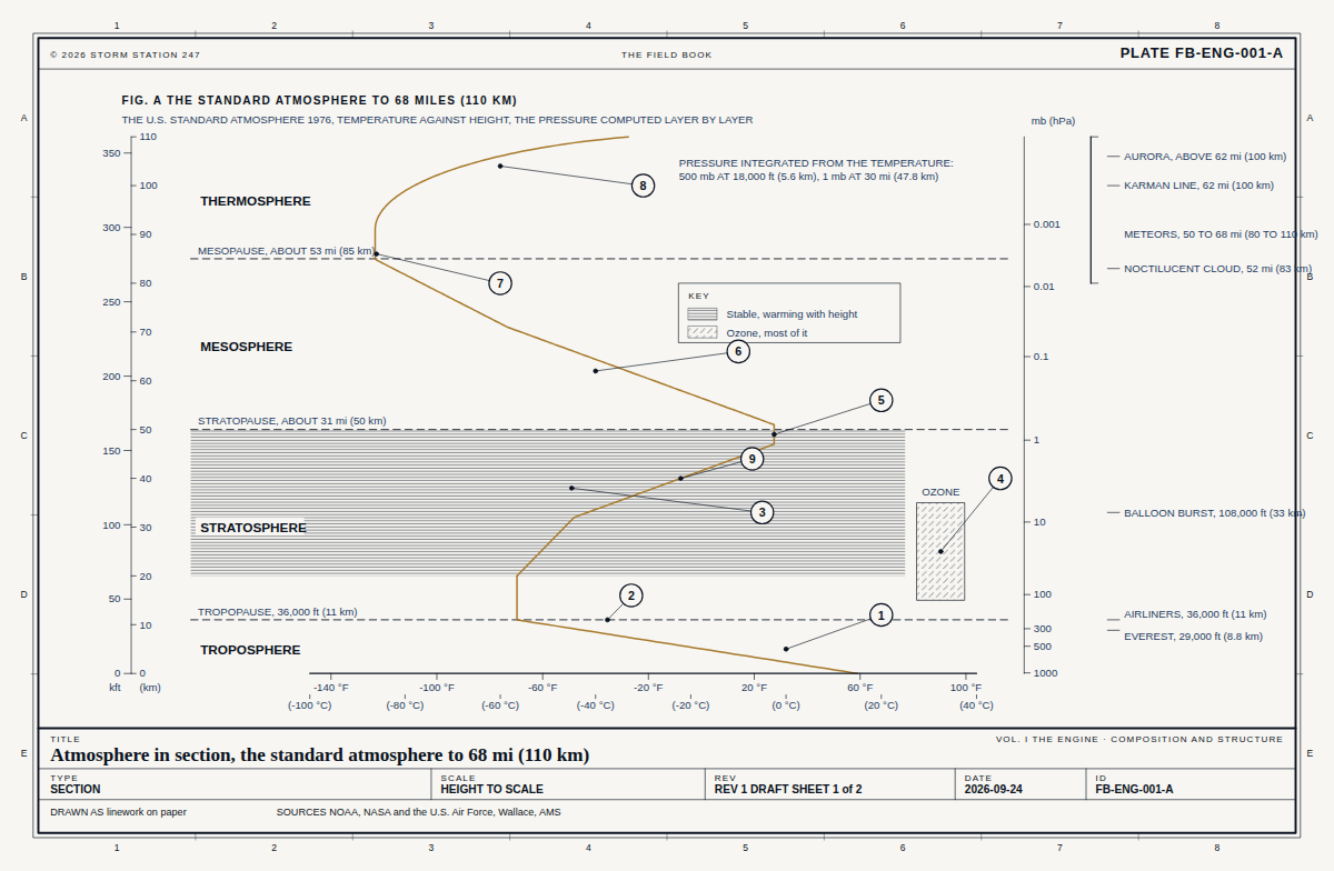
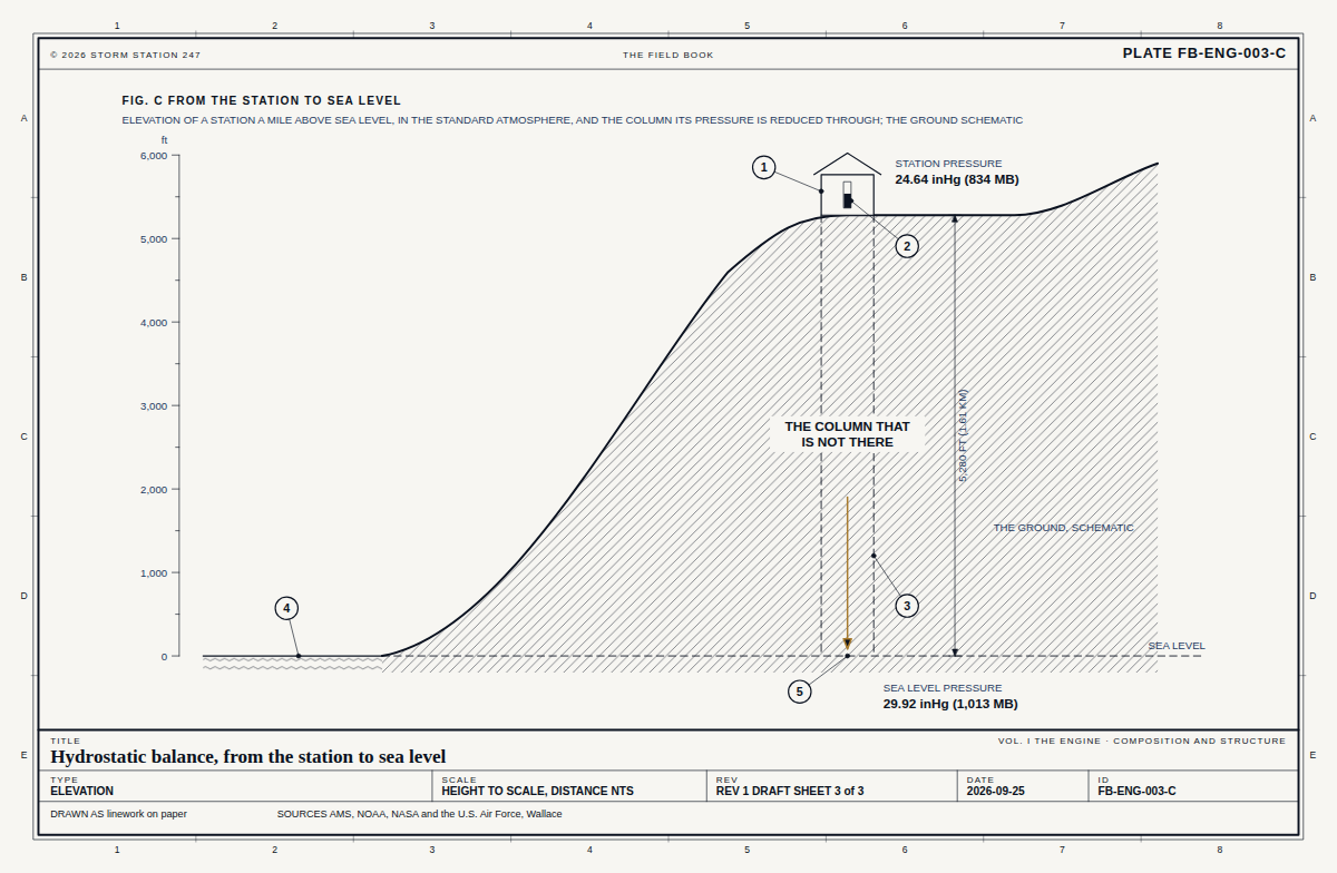
Section from sea level of where Dutch Harbor stands in the atmosphere, height to scale: the station 13 feet above sea level with 0 per cent of the air below it; the standard atmosphere's pressure there, 29.91 inches of mercury, and temperature, 59.0 degrees Fahrenheit; the altimeter setting of 29.96 and the station pressure it means, 29.95. 1 1 2 2 3 3 4 4 5 5 6 6 7 7 8 8 A A B B C C D D E E © 2026 STORM STATION 247 THE FIELD BOOK STATION REPORT PADU FIG. D WHERE DUTCH HARBOR STANDS IN THE ATMOSPHERE SECTION FROM SEA LEVEL, HEIGHT TO SCALE, THE STATION IN THE STANDARD ATMOSPHERE FT ABOVE SEA LEVEL 0 5,000 10,000 15,000 SEA LEVEL, 29.92 inHg IN THE STANDARD ATMOSPHERE DUTCH HARBOR 0 PER CENT OF THE AIR BELOW IT 13 FT 10 PER CENT OF THE AIR BELOW, 2,890 FT 20 PER CENT OF THE AIR BELOW, 6,050 FT 30 PER CENT OF THE AIR BELOW, 9,540 FT 40 PER CENT OF THE AIR BELOW, 13,470 FT STANDARD PRESSURE HERE 29.91 inHg STANDARD TEMPERATURE HERE 59.0 F ALTIMETER SETTING, REPORTED 29.96 inHg ITS BAROMETER READS 29.95 inHg TEMPERATURE, REPORTED 46.0 F TITLE Dutch Harbor, the column STATION REPORT · ASOS PADU TYPE SECTION SCALE HEIGHT TO SCALE REV AS REPORTED SHEET 4 of 6 DATE 2026-09-30 ID SR-PADU-4 DRAWN AS linework on paper SOURCES FB-ENG-001, FB-ENG-003 On Sep 30 the noon sun stands 33 degrees above the horizon at 53.90 N, and the day is 11 h 26 min long. Level ground there takes 54 per cent of the noon sunlight a surface facing the sun would.
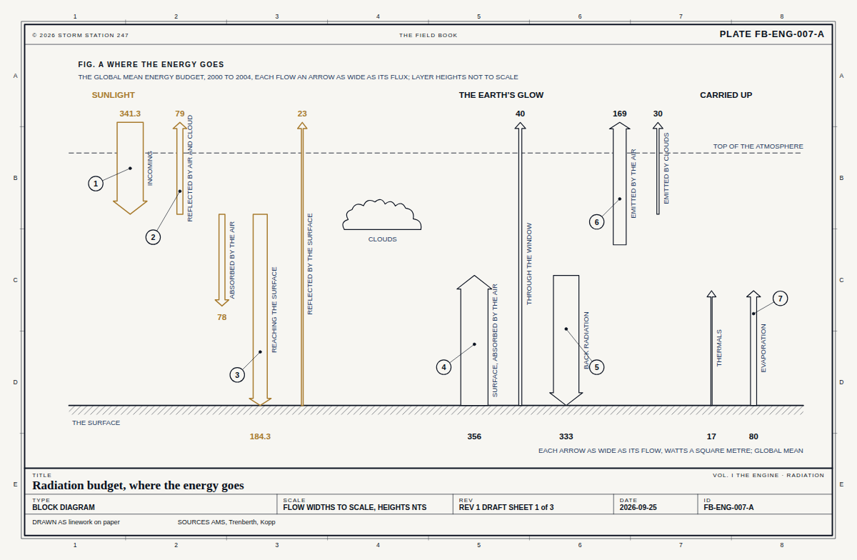
Elevation of the noon sun at Dutch Harbor, angles true: on Sep 30 it stands 33 degrees above the horizon, against 60 at the June solstice, 36 at the equinoxes and 13 at the December solstice; the day is 11 h 26 min long. 1 1 2 2 3 3 4 4 5 5 6 6 7 7 8 8 A A B B C C D D E E © 2026 STORM STATION 247 THE FIELD BOOK STATION REPORT PADU FIG. E THE SUN AT DUTCH HARBOR ELEVATION LOOKING WEST, SOUTH TO THE LEFT: THE NOON SUN ON THE DAY OF THE REPORT, AND AT THE SOLSTICES AND EQUINOXES; ANGLES TRUE THE STATION JUNE SOLSTICE 60° EQUINOXES 36° DECEMBER SOLSTICE 13° SEP 30, 33° SOUTH ANGLES TRUE; THE RAYS ARE OF ONE LENGTH AND DRAW DIRECTION ONLY DAY LENGTH 11 H 26 MIN LEVEL GROUND TAKES 54 PER CENT OF THE NOON SUN A FACING SURFACE WOULD LATITUDE 53.90 N; THE SUN'S DECLINATION -3.1° TITLE Dutch Harbor, the sun STATION REPORT · ASOS PADU TYPE ELEVATION SCALE ANGLES TRUE REV AS REPORTED SHEET 5 of 6 DATE 2026-09-30 ID SR-PADU-5 DRAWN AS linework on paper SOURCES FB-ENG-007 An airport station, 13 ft above sea level. Its report of Sep 30, 2026, 5:56 AM local time is written on the sensors that made it.
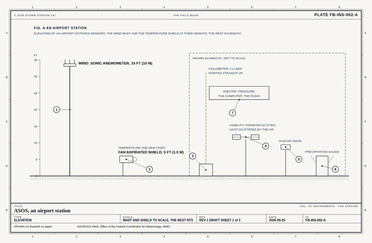
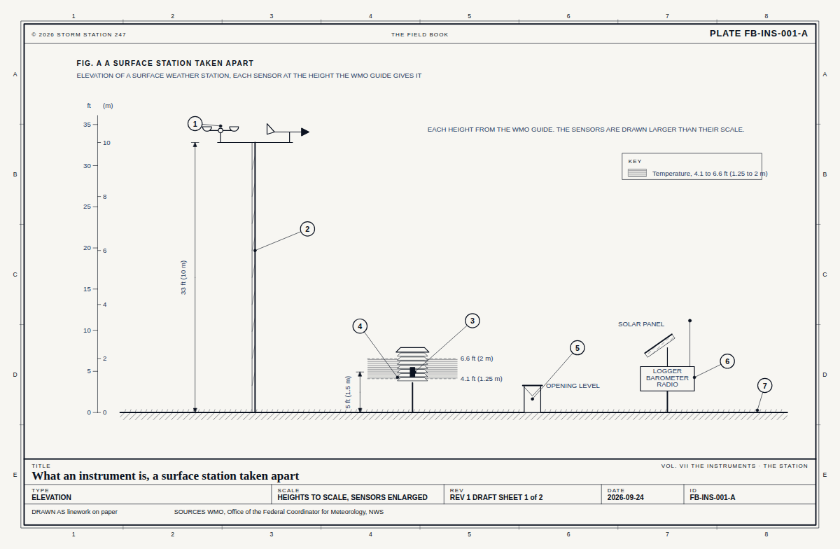
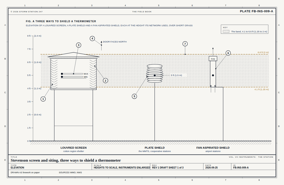
Elevation of an airport station, Dutch Harbor, each sensor drawn and labelled with what it read: barometers, in the shelter, altimeter 29.96 inhg; heated rain gauge, 0.00 in today; visibility sensor, 7 ft, 10 mi or more; ceilometer, looking up, sct 3,000 ft; temperature in its shield, 5 ft, 46.0 f, dew point 40.0 f; wind, 33 ft, from 190°, 8 mph. 1 1 2 2 3 3 4 4 5 5 6 6 7 7 8 8 A A B B C C D D E E © 2026 STORM STATION 247 THE FIELD BOOK STATION REPORT PADU FIG. F THE INSTRUMENT ELEVATION OF AN AIRPORT STATION, EACH SENSOR WITH WHAT IT READ, SEP 30, 2026, 5:56 AM LOCAL TIME BAROMETERS, IN THE SHELTER ALTIMETER 29.96 inHg HEATED RAIN GAUGE 0.00 IN TODAY VISIBILITY SENSOR, 7 FT 10 MI OR MORE BEAM CEILOMETER, LOOKING UP SCT 3,000 FT TEMPERATURE IN ITS SHIELD, 5 FT 46.0 F, DEW POINT 40.0 F WIND, 33 FT FROM 190°, 8 MPH 33 FT 5 FT HEIGHTS TO SCALE; THE SPACING BETWEEN SENSORS IS NOT TITLE Dutch Harbor, the instrument STATION REPORT · ASOS PADU TYPE ELEVATION SCALE PARTLY TO SCALE REV AS REPORTED SHEET 6 of 6 DATE 2026-09-30 ID SR-PADU-6 DRAWN AS linework on paper SOURCES FB-INS-002, FB-INS-001, FB-INS-009 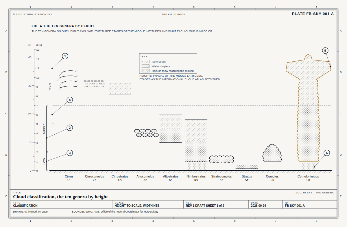 FB-SKY-001, Fig. ACloud classification
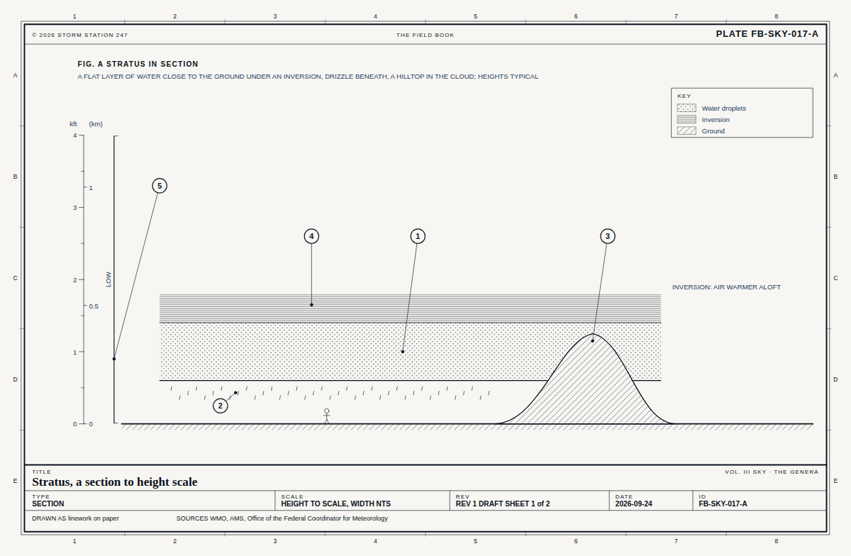 FB-SKY-017, Fig. AStratus
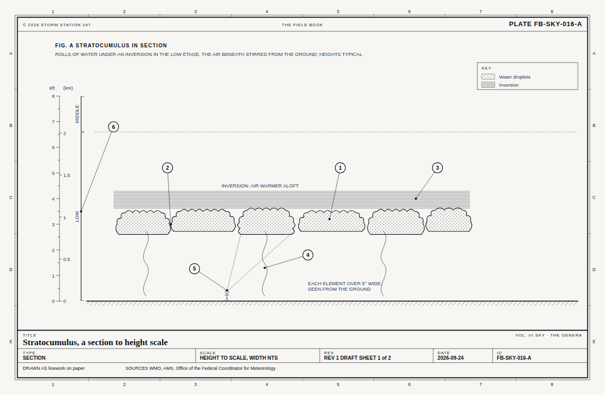 FB-SKY-016, Fig. AStratocumulus
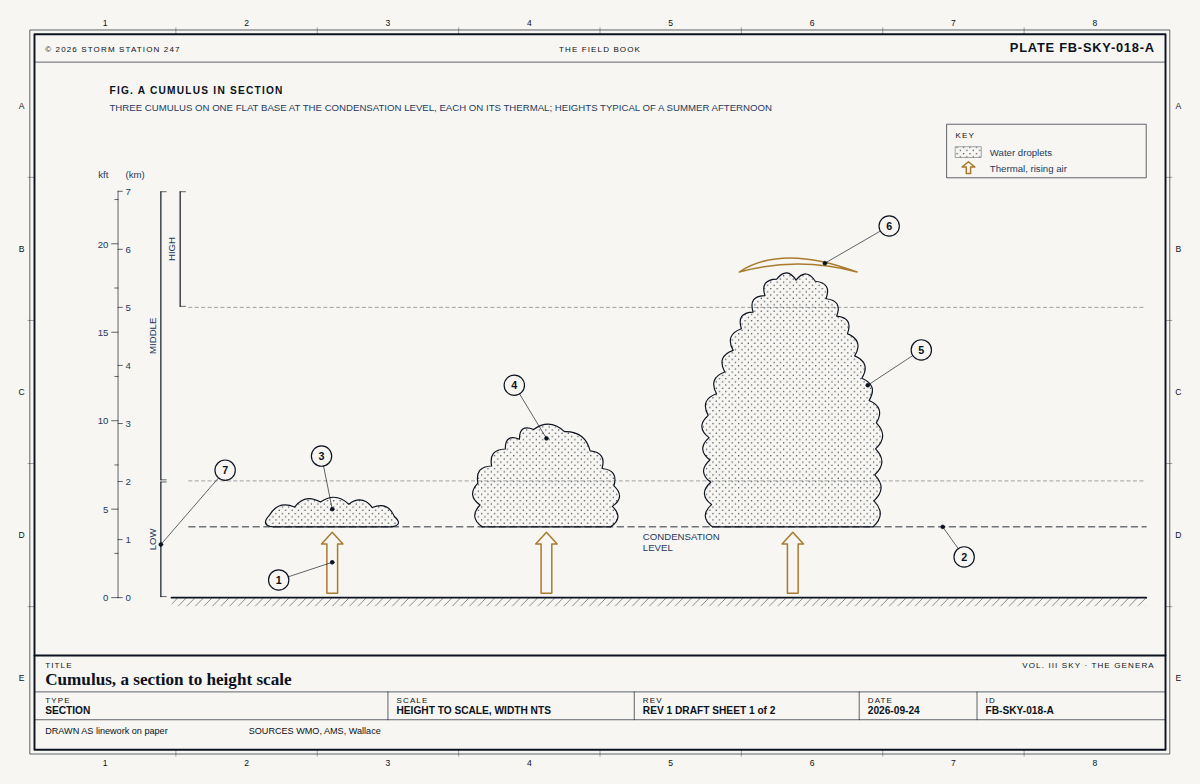 FB-SKY-018, Fig. ACumulus